GOL - live tanker position
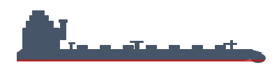
Crude Oil Tanker · IMO 9325049 · Antigua & Barbuda
Destination
KHOR AL ZUBAIR
Last Known Position
25.3160°, 56.8316° at 12.0 kn as of 2026-10-27 17:53 UTC
AIS positions may be delayed.updated 2d ago
GOL is a Crude Oil Tanker with IMO 9325049, flagged in Antigua & Barbuda. TankerMap last observed this vessel on 2026-10-27 17:53 UTC. Latest destination: KHOR AL ZUBAIR. Speed was 12.0 knots. Recent track includes 35 sampled positions.
MMSI
305044400
Built
2007
Gross Tonnage
83,469 GT
Deadweight
158,425 DWT
Size
274 / 48
Flag
Antigua & Barbuda
Data Source
TankerMap AIS
Ownership & Management
| Registered Owner | SONANGOL SHIPPING NAMIBE LTD |
| Ship Manager | STENA BULK LLC |
| ISM Manager | WALLEM SHIPMANAGEMENT LTD |
| Status | In Casualty Or Repairing |
| Call Sign | C6VR3 |
View live on map → View Voyage History →
Recent Track (14 days)
Similar Vessels
News mentioning GOL
Hormuz tensions risk delaying Middle East oil supply recovery
Jul 09, 2026
Hormuz risks keep oil shipping in focus despite US-Iran ceasefire
Jul 07, 2026
Goldman sees oil surplus return as Hormuz traffic recovers
Jul 01, 2026
Goldman says Hormuz oil flows may recover to only 70% after war
Jun 18, 2026
Goldman warns of US diesel crunch if Hormuz disruption persists
Jun 02, 2026
Data source: TankerMap AIS. Updated periodically.